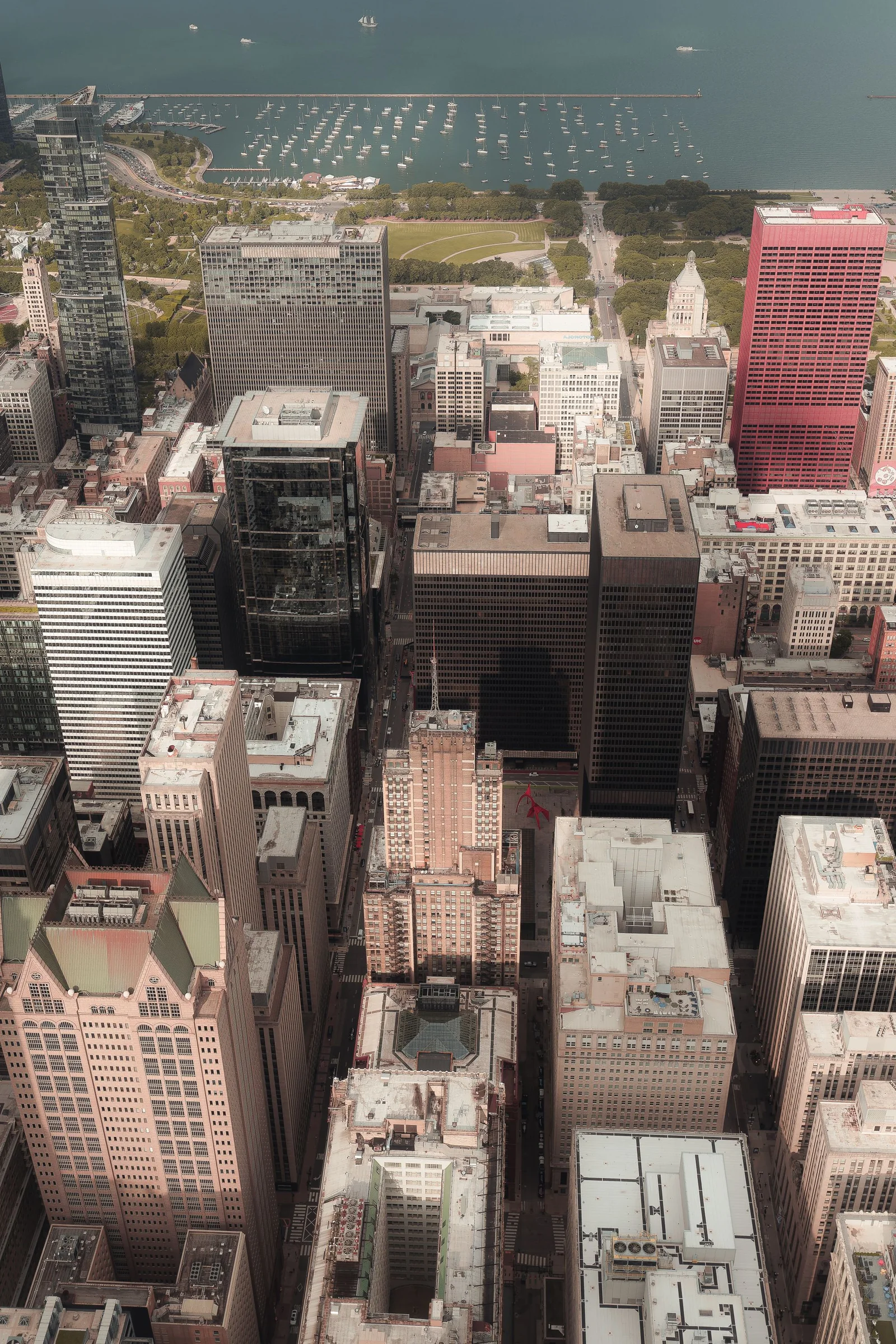
A Chicago drone shoot rarely has one all-purpose “permit.” It has a stack of decisions made by different authorities. The Federal Aviation Administration controls the airspace and the federal operating framework. A property owner or manager controls the roof, lot, courtyard, loading area, or private parcel used by the crew. The City may regulate production activity in a public way. The Chicago Park District controls its parks and listed filming uses. Airports, venues, transit operators, railroads, utilities, campuses, and event organizers can impose additional property and security rules. Weather and actual ground conditions still determine whether an approved plan can be flown safely.
That separation is the key to useful planning. FAA authorization does not provide a roof key. A building manager’s email does not authorize controlled-airspace flight. A Park District permit does not waive Part 107. A City film permit does not give the crew control of a neighboring parcel or guarantee that crowds and traffic will match the proposed path. Treating those permissions as interchangeable creates expensive failure points.
This checklist is for producers, agencies, owners, contractors, brokers, venue teams, and organizations commissioning commercial aerial photography or video in Chicago. It is not legal advice and cannot approve a specific operation. Rules, forms, airspace, temporary restrictions, site policies, and event conditions change. The remote pilot and production team must verify the current facts for the exact coordinates, altitude, dates, ground area, subject, and intended use. Start with the Chicago project request form when you have an address and creative brief.
Freeze the scope before beginning permit research
Record exact coordinates, not a neighborhood name
“Downtown,” “the lakefront,” “near Wrigleyville,” or “by the airport” is not enough information for an airspace or property review. Record the latitude and longitude of the proposed launch and landing area, the horizontal operating footprint, the highest requested altitude, the direction of each planned move, and any alternate ground positions. Include every address in a multi-location day.
The subject location and the launch location may be different. A client may want to photograph a tower from an adjacent roof, a parcel from a neighboring lot, or a venue from private property across the street. Every ground position needs its own controller and access plan. Every change in the operating footprint can affect obstacles, people, traffic, visual line of sight, and airspace conditions.
Use a simple site map. Mark the subject, property lines supplied by the client, preferred launch area, alternate launch area, roads, rail, water, helipads, cranes, antennas, bridges, towers, public spaces, event activity, and the intended flight volume. Label which facts are confirmed and which remain assumptions.
Define what the aircraft must capture
Permit research is more productive when the team knows which images are essential. A construction record may need four repeatable oblique views and a roof overview. A property film may need entrance, elevations, parking, transit context, and skyline orientation. An event may need an empty venue exterior before opening and a separate crowd-free branded reveal. A generic request for “cinematic aerials” gives the pilot no basis for proposing a lawful substitute when one move is constrained.
Prioritize shots as essential, valuable, or optional. State required focal relationships rather than prescribing an exact path. “Show the building with the river and Loop context” gives the team more room than “fly down the river and orbit the tower.” The first is a communication goal. The second may depend on ground control, sight lines, people, vessels, bridges, building wake, and airspace conditions that have not been verified.
Create a permission register
For each shot, list the airspace path, launch-property controller, any public property affected, venue or facility contact, people and vehicle conditions, and required media clearance. Assign an owner and due date for every unresolved approval. A permission register turns a vague permit question into a production schedule.
Add evidence fields: authorization number, written property approval, permit document, certificate of insurance recipient, access window, security contact, restrictions, and expiration. Save current copies with the call sheet. Do not rely on a message that says only “drones are fine” without confirming what the person controls.
Set dates, alternates, and approval deadlines
Permits and authorizations require lead time, but weather cannot be fixed weeks in advance. Build a primary date, weather alternate, and approval deadline into the brief. Ask whether property access, street occupancy, police or security, talent, event operations, and vendor credentials can move to the alternate date.
Some approvals attach to a specific day and time. Some facilities require an advance scout, insurance language, escort, or vendor onboarding. Some event sites become unavailable during loading, rehearsals, peak arrival, or teardown. A production that reserves only the pilot’s calendar is not fully scheduled.
Verify federal operating authority and airspace
Confirm Part 107 responsibilities
Commercial small-drone operations generally fall under the FAA’s Part 107 framework. The FAA’s Part 107 overview describes operating rules and the remote pilot’s responsibilities. The production should confirm the remote pilot certificate, aircraft registration where required, Remote ID compliance, preflight condition, visual-line-of-sight plan, and applicable operating limitations.
The person hiring the crew should understand the difference between a certified pilot and an approved operation. A certificate establishes that a person met the FAA’s remote-pilot requirements. It does not automatically authorize any altitude, any route, flight over any gathering, launch from any property, or operation in any weather. The remote pilot in command remains responsible for determining whether the planned operation can be conducted under the rules and any authorization or waiver.
Ask who will be the remote pilot in command, who has final authority to cancel or modify the flight, and whether a visual observer or additional crew member is needed. A producer, client, or venue representative may control creative approval and property access, but cannot override the pilot’s safety decision.
Check controlled airspace at the actual flight volume
Chicago contains complex controlled-airspace environments associated with O’Hare, Midway, and other aviation facilities. The FAA explains that operations in controlled airspace require authorization and provides eligible near-real-time requests through LAANC. The authorization applies to stated conditions. It does not convert an entire neighborhood into an unrestricted operating area.
Review the exact coordinates and intended altitude in current FAA tools. A nearby address may fall under a different grid or ceiling. A low authorization may still support useful façade or site-context images if the shot list is designed for it. Conversely, a requested high skyline view may be unnecessary once the communication goal is clarified.
Do not promise an authorization before it exists. Build a creative option for a lower altitude, tighter footprint, alternate owner-controlled parcel, ground-based camera, or different composition. The goal is not to “beat” airspace. It is to design a useful result within verified constraints.
Distinguish authorization, waiver, and notification
An airspace authorization allows an operation in controlled airspace under specified conditions. A Part 107 waiver is a separate FAA approval to deviate from certain regulations when the applicant demonstrates an acceptable safety case. A message to an airport, security desk, or property manager is not automatically either one.
The FAA maintains a current Part 107 waivers page explaining the waiver process and covered rules. When a concept appears to require a waiver, plan around the actual approval timeline and conditions rather than assuming the pilot’s experience replaces it.
Check restrictions that can change by date
Temporary flight restrictions, security events, emergency activity, major sporting events, and other conditions can affect a date that looked workable during the first scout. Recheck current federal sources during planning and again before flight. A screenshot saved weeks earlier is not a final airspace briefing.
Hospital helicopters, news aircraft, law enforcement, construction cranes, and other local activity may not appear as a simple red boundary on a consumer app. The pilot must maintain awareness and yield as required. A well-planned operation includes a loss-of-link response, landing area, obstacle review, communication plan, and a clear trigger for stopping when the environment changes.
Obtain permission for the ground and production activity
Get written private-property control
Identify the legal owner or authorized manager of the launch and staging property. A tenant, broker, event planner, general contractor, or marketing contact may not control the roof or lot. Written approval should identify the date, time, areas permitted, crew size, access route, parking, roof or elevator procedure, escort, insurance, and any restricted zones.
For a high-rise, confirm roof access, parapets, antennas, window-washing equipment, mechanical areas, maintenance work, and whether a roof representative must remain present. For construction, coordinate with the superintendent and understand crane picks, concrete pours, deliveries, exclusion zones, and required personal protective equipment. For an industrial property, address trucks, rail spurs, yard rules, security, and tenant operations.
Permission to stand on a property is not permission to fly beyond the legal and approved operation. It also does not transfer control of people, vehicles, adjacent parcels, rail, or public ways. The property letter should be one entry in the register, not the entire permit plan.
Use Chicago’s public-way film process when the production triggers it
Chicago’s municipal code defines a “film production event” around exclusive use of streets, sidewalks, or other public way for vehicles, equipment, or crew; requested City services; and specified production activities. The official film production permit code section says such an event requires a City Services Request Form and a CDOT Film Production Permit. It also distinguishes unobstructive public-way filming from activity that meets the definition.
Do not self-classify a drone base as “small” without evaluating actual impact. A spotter, cases, cones, production vehicle, client group, reserved curb space, or pedestrian control can change the footprint. If a crew needs a closure, barricade, parking restriction, police support, or exclusive public-way use, contact the Chicago Film Office early and follow the current process.
The code and application materials also address insurance, indemnification, site information, dates, traffic interruption, and requested services. Requirements and fees can change. Link the current official application in the production record instead of copying an old amount into a reusable budget.
Treat Park District land as its own approval track
The Chicago Park District’s filming and photography permit page says permits are required for listed uses including commercial shoots, web-based media, wedding photography, documentaries, and other production categories. Its general permits page identifies flying machines such as drones among activities requiring special-event consideration.
That matters along the lakefront, in major parks, around harbors, near beaches, and at landscaped neighborhood locations. “It is public land” does not mean it is an open launch pad. Contact the Park District with the exact park, activity, crew footprint, date, and intended media use. Determine whether the request involves filming permission, a special-event process, a location agreement, insurance, or another review.
Keep the air and ground approvals separate
A Park District approval addresses Park District-controlled activity; it does not authorize controlled airspace or waive Part 107. FAA authorization addresses airspace; it does not grant use of a park. The shoot file should contain both when both apply.
If a park launch is unavailable, consider a verified private-property alternative only if it supports a lawful, safe, and useful operation. Do not move the crew across the street and assume the same flight is solved. Recheck the footprint, property controller, people, traffic, visual line of sight, and airspace for the new plan.
Confirm facility-specific rules for airports, transit, rail, bridges, and venues
The Chicago Department of Aviation says commercial filming on property at O’Hare and Midway requires written permission. Its commercial filming guidance describes advance inquiry, a scout, policy review, insurance, and required coordination. Airport property permission remains separate from FAA control of the airspace.
CTA facilities, Metra or freight rail property, bridges, utilities, stadiums, museums, universities, McCormick Place, Navy Pier, and secured corporate campuses can have their own contacts and security rules. A client’s desire to show the facility is not access approval. The production should identify whether the image can be made from controlled property without entering or operating over a restricted site.
For event work, use the Chicago concert and event planning service to begin the operational brief, but obtain written venue and organizer approval. Clarify setup, loading, rehearsals, pyrotechnics, radios, security zones, attendee ingress, talent, temporary structures, and the exact exterior window.
Convert the shot list into an operational plan
Map people, traffic, vessels, and moving equipment
Federal rules concerning operations over people and moving vehicles cannot be replaced by a client release or venue permission. Record where pedestrians, attendees, workers, motorists, cyclists, trains, boats, cranes, and deliveries will be during each shot. Identify whether the production can control an area, schedule a quiet window, change the route, or omit the move.
Chicago locations can change rapidly. A Riverwalk segment quiet at dawn may be busy later. A construction access route can fill with deliveries. A lakefront path, arterial, bridge, or plaza may not be controllable by the property owner. A venue’s exterior can transition from an empty campus to dense arrival activity within minutes.
Design each flight segment with a launch area, flight volume, visual-line-of-sight position, observer role if used, landing or contingency area, and abort trigger. The call sheet should tell the crew who can pause site activity and how communication will work.
Check structures and micro-weather on site
Tower spacing, parapets, rooftop mechanical systems, cranes, antennas, bridges, and street canyons can create turbulence or block sight lines. Wind at sidewalk level is not a reliable measure of wind at roof height. Lake-influenced cloud and mist may change visibility while an inland forecast remains acceptable.
Use current National Weather Service forecasts, observations, and aviation products along with on-site measurements and the aircraft’s limitations. Chicago’s official climate normals provide context, not permission. The pilot needs actual conditions for the time and place.
Cold requires deliberate battery handling and access planning. Snow and ice can eliminate a roof position, hide trip hazards, or change the subject. Summer heat, haze, thunderstorms, and changing lake breeze can alter performance and the visual standard. Define both a safety threshold and a creative threshold.
Write explicit stop conditions
Examples include loss of required visibility, wind or gust behavior outside the operating plan, unexpected people or vehicles entering a controlled area, uncoordinated crane or helicopter activity, lost communication, a security instruction, unavailable landing area, or any condition the pilot judges unsafe. The remote pilot should not need a producer’s permission to stop.
Record who has authority to resume after a hold. If the condition cannot be corrected within the window, move to the alternate shot, ground capture, or weather date. A planned stop is professional production control, not failure.
Build useful alternatives for constrained shots
An alternate should preserve the communication goal. If a high orbit is unavailable, a lower oblique view may still show entrances, elevations, and street context. If an event crowd changes the flight plan, empty-campus exteriors captured during setup may provide stronger branding. If a park position is not permitted, an owner-controlled rooftop may offer a lawful composition—subject to a fresh review.
Ground cameras, long lenses, stabilized handheld work, permitted elevated positions, graphics, maps, and supplied interior media can complete a story without forcing the aircraft into every sentence. The Chicago real-estate video service can combine aerial context with property-level details when a purely aerial plan would be less useful.
Document approvals and verify again before flight
Assemble a production packet
The final packet should contain the creative brief, exact coordinates, site map, shot priorities, FAA authorization or relevant documentation, pilot and aircraft information, written property permission, City or Park District permits where applicable, facility approvals, insurance certificates, crew contacts, access instructions, security procedures, weather plan, communication method, and emergency or contingency notes.
Include the limitations, not just the approval. If an authorization sets a ceiling or time, place it next to the shot list. If a property approval restricts a roof zone or requires an escort, show it on the map. If a permit reserves a limited public area, tell the crew exactly what remains open to the public.
For Chicago wedding and engagement drone photography, add the venue’s written drone policy, ceremony schedule, guest-arrival window, photographer and videographer coordination, privacy preferences, and a separate exterior opportunity. A general venue contract may not authorize aircraft activity.
Conduct a final go/no-go review
Recheck airspace and restrictions, current weather and visibility, property access, permits, insurance, crew, aircraft condition, Remote ID, batteries, storage media, communications, ground activity, cranes, events, and emergency conditions. Confirm that the site still resembles the scout and that the authorized footprint is usable.
Walk the essential shots in order. If the plan depends on a public area remaining empty, a roof being unlocked, a loading zone being clear, or a security escort arriving, verify it before launching. Do not allow the aircraft to become the first tool used to discover the site.
Preserve an auditable record after the shoot
Save the operative approvals, call sheet, flight notes, change decisions, and delivered-file manifest with the project. For recurring Chicago construction drone photography, keep the coordinates, fixed-view definitions, access assumptions, and date-specific differences so the next visit begins with evidence rather than memory.
If the client later asks for a new use, new address, new date, different path, higher altitude, crowd sequence, or neighboring subject, reopen the review. An approval is not a reusable blanket permission for every production concept.
Use a final six-layer check
Before flight, confirm: federal operating compliance; current airspace authorization and restrictions; written launch-property control; City, Park District, or other public-property permission; facility or venue rules; and current operational conditions. The sixth layer includes weather, visibility, people, traffic, equipment, obstacles, and crew readiness.
A Chicago drone filming plan is ready only when all six agree with the exact shot list. That discipline protects the schedule and usually improves the creative result: the team knows what matters, where it can work, which alternatives preserve the story, and who owns every decision. Keep the completed checklist with the project record, note any day-of changes, and require a new review whenever the location, altitude, route, timing, access plan, or intended use changes.